White Pine Lake
White Pine Lake is a small alpine lake located on the boundaries of the Lone Peak Wilderness in Little Cottonwood Canyon, Utah. The lake sits at 10,000 feet in a large granite* cirque etched out by glacial activity in the Wasatch Mountains during the last glacial maximum around 18,000 years ago. White Pine Canyon was originally used for logging operations, with little to no mining activity. The White Pine drainage was left out of the wilderness area designated in 1978 by Congress under the Endangered American Wilderness Act (1), mainly due to the ski lobbyists (Snowbird Resort is just to the east of the canyon). Though not part of the wilderness area, and thankfully not turned into a ski area, the canyon offers amazing alpine landscapes with towering peaks and diverse wildlife and flora. Heavily forested, the lower elevations have large groves of Aspens and Douglas Firs. The higher areas have spruce and fir groves, and high alpine grasses and wildflowers. Red Pine Canyon is to the west over the ridge, and the trail is accessed form the Red Pine/White Pine trailhead near Tanner Flat Campground. The trailhead provides access to White Pine, Red Pine, and Maybird Canyons. The best time to go up there is summer into fall without the aid of snowshoes, as snow can persist through June on the north slopes.
*The "Granite" is actually quartz monzonite, which is not quite grant but pretty close. The rock is part of the Little Cottonwood Stock, which was a volcanic intrusion that occurred around 30 million years ago. They are much younger than the older metamorphic and sedimentary rocks found in other canyons in the Wasatch Mountains.
(1) http://www.fs.usda.gov/detail/uwcnf/about-forest/districts/?cid=fsem_035453
The trail
|
Distance: 10 miles
Duration: 6-8 hours Trailhead: White Pine/Red Pine Trailhead Difficulty: Moderate Directions: From I-15 take the exit on the belt route to I-215 Eastbound. Follow I-215 until you reach the exit for Cottonwood Heights (there are signs saying ski areas Brighton and Solitude). Exit I-215 and get on Wasatch Boulevard following south past Big Cottonwood Canyon to Little Cottonwood Canyon. Follow the Little Cottonwood Canyon Road for a few miles, passing Tanners Flat Campground and reaching the sign that says White Pine/Red Pine Trailhead. You can park on the road if you need to. The trailhead has a pit toilet. Description: From the trailhead, follow the trail around and over the bridge crossing Little Cottonwood Creek. There is a map of the area here. The trail follows an old jeep road up the sides of Little Cottonwood Canyon, eventually coming to a backcountry bulletin board. Here is the split off for Red Pine Lake and the Maybird Gulch. For White Pine Lake, stay on the jeep road that forks off to the left. The jeep road will take you all the way to the lake. Since it is a jeep road, it is well graded and not very steep, which is why this is a more moderate hike. The road travels through groves of firs and spruces and aspens, climbing into the alpine regions. The road sticks to the eastern slope of White Pine Canyon, offering views of the peaks across the canyon. The road eventually comes to a large talus field at the base of Red Baldy (11,171 feet), and White Baldy (11,321 feet). Here it can be a little sketchy (especially if there is snow) but nothing crazy. After you cross the talus field, you descend a couple hundred feet down into the cirque with the lake. There is no shoreline (unless you count the boulders), so just find a rock to rest on and take in the deep glacial blue of the lake. Return the way you came. |
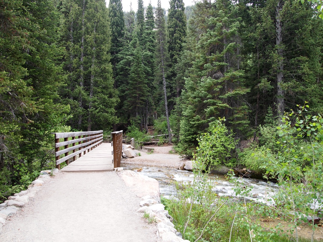
- Bridge over Little Cottonwood Creek from the trailhead.
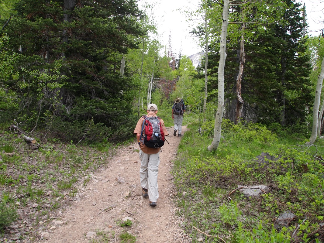
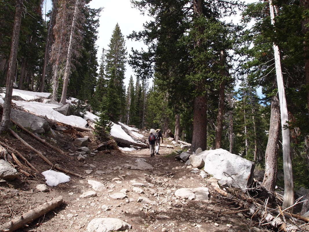
-The trail as it slowly climbs through the trees.
|
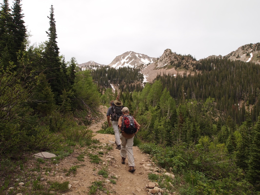
-Reaching the higher elevations looking toward the main cirque.
- Running into snow in the high spruce forests.
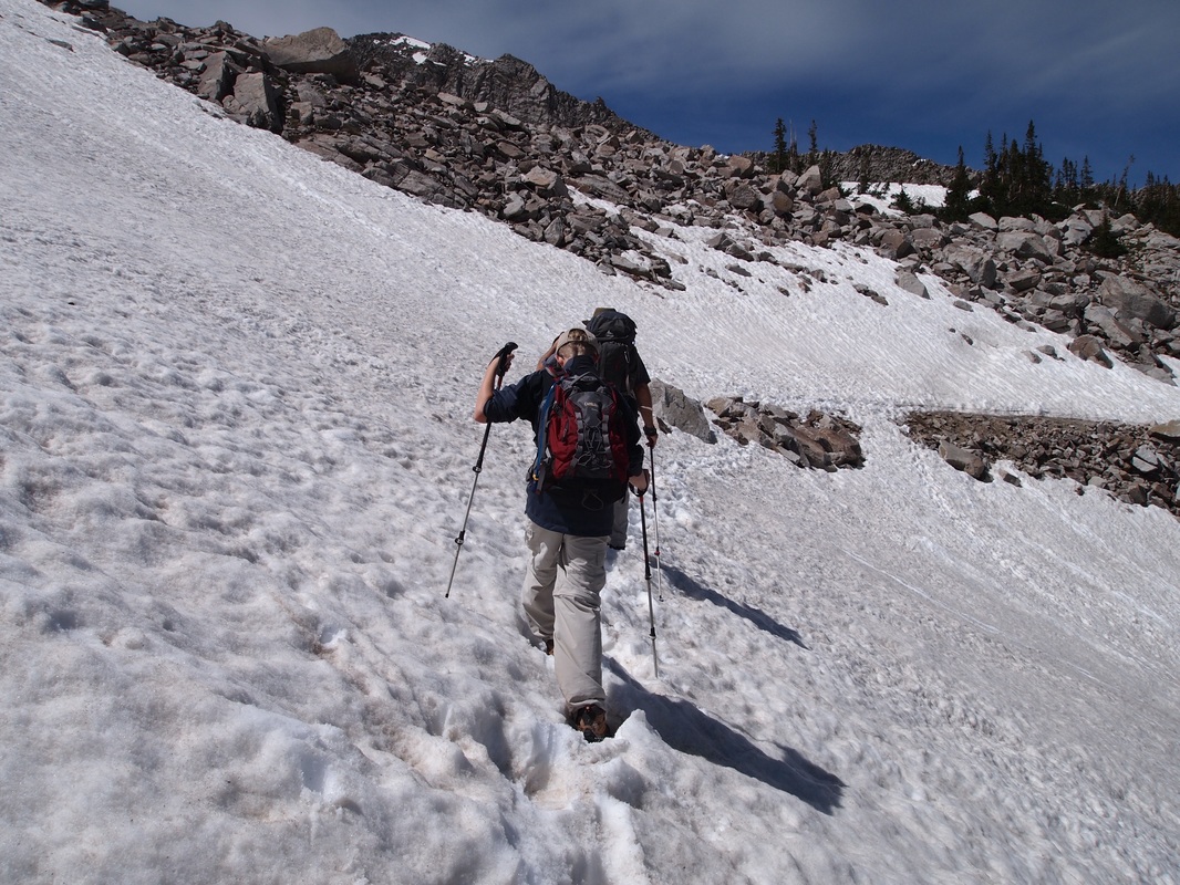
Traversing through the snow on the Talus field.
|
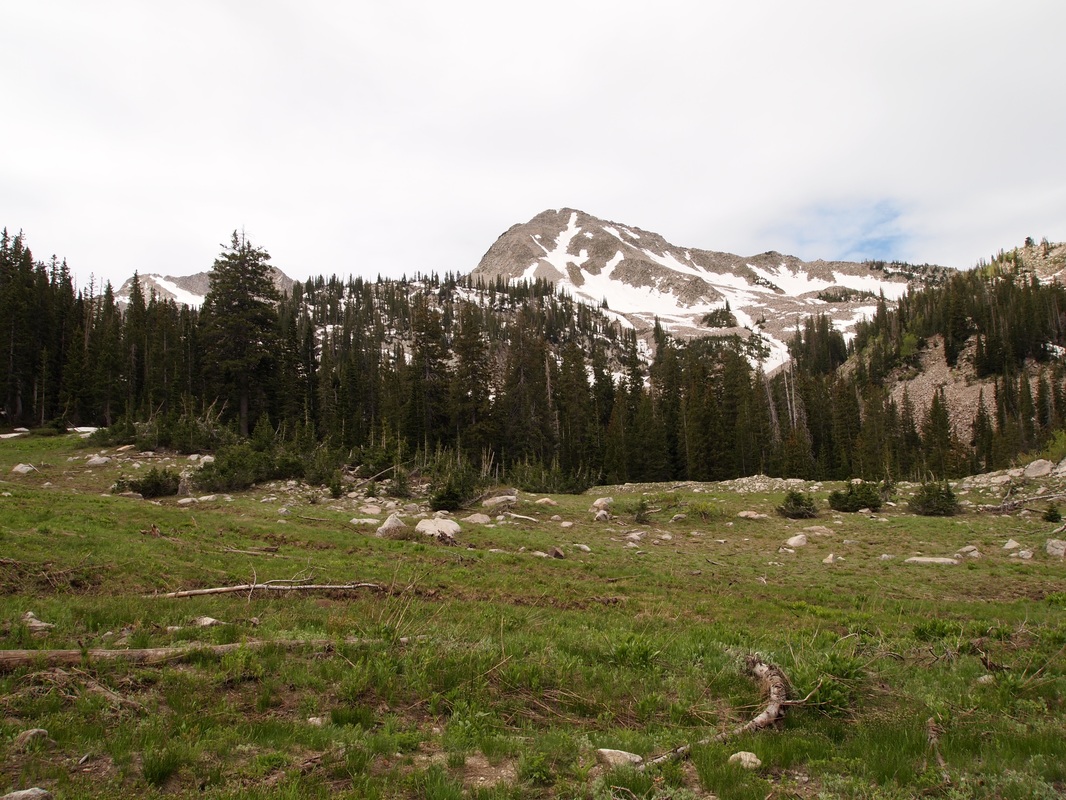
-Looking toward the main cirque from an open meadow.
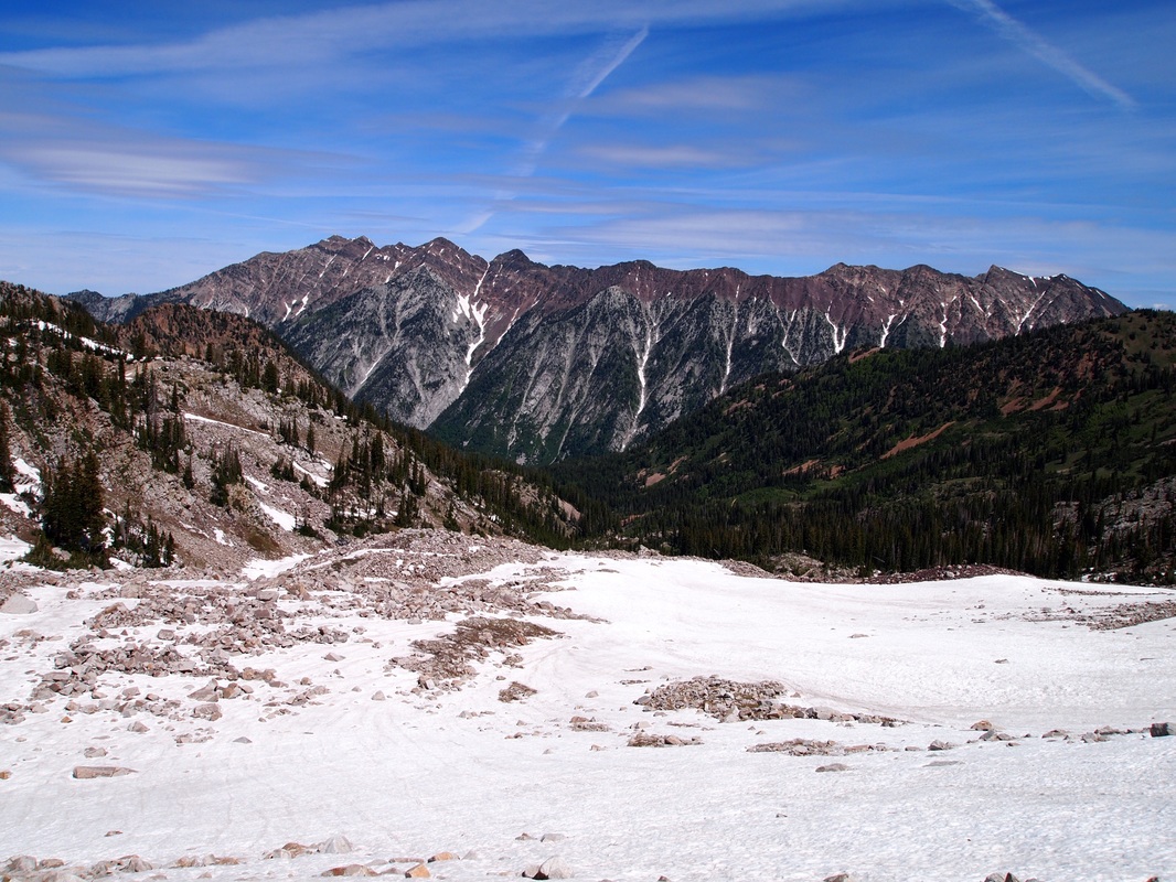
- View north from the talus field.
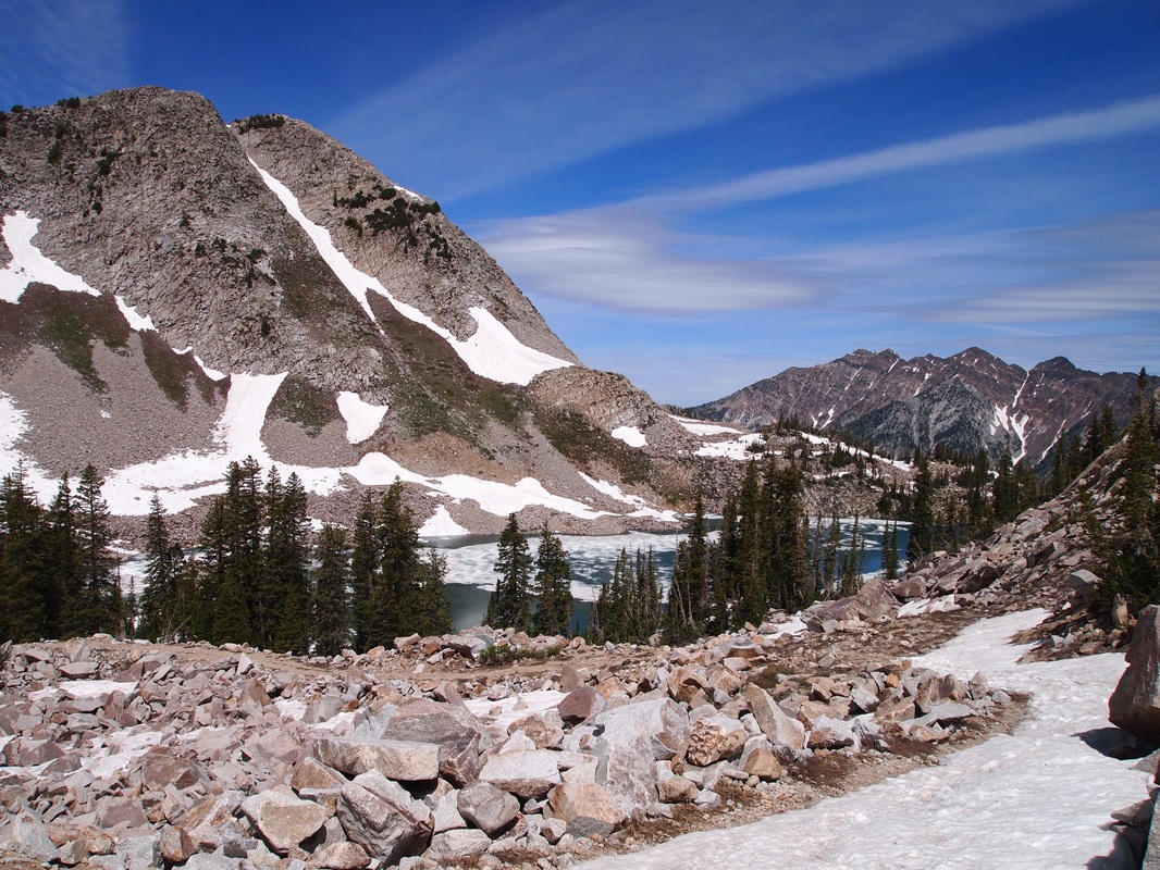
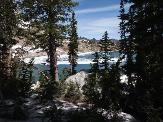
- Dropping on down to the lake (looking northwest).
|
