maybird Gulch
Maybird Gulch is a small alpine cirque and hanging valley located in the Lone Peak Wilderness area of Utah. The gulch is one of three possible destinations from the White Pine/ Red Pine trailhead in Little Cottonwood Canyon, the other's being White Pine Lake and Red Pine Lake. The gulch is made of the same quartz monzonite from the Little Cottonwood Stock (which is essentially granite), and was carved out by glacial activity during the last ice age. The cirque is mostly boulder and erosion debris, and is the perfect place to see alpine life such as Marmots and Pikas. The gulch provides main climbing access to the Pfeifferhorn (or Little Matterhorn) peak, which towers several hundred feet above the cirque. In the gulch there are 2 (sometimes 3 depending on snow) small lakes known as the Maybird Lakes. The name Maybird likely comes from the prospectors and loggers that were active in the canyon in the late 1800's, possibly named after a local woman or daughter. The gulch is not as heavily visited as its neighbors, and is a good hike for those looking for some seclusion in one of the prettiest wilderness areas in the country.
The Trail
|
Trailhead: White Pine/ Red Pine Trailhead, Little Cottonwood Canyon
Duration: 5-8 hours Distance: 7.5 miles Difficulty: Moderate to Strenuous Directions: From I-15 take the Belt Route exit onto I-215 east. Follow I-215 east until you reach the Cottonwood Heights exit, and then get on Wasatch Boulevard heading south. Follow Wasatch Boulevard past Big Cottonwood Canyon to Little Cottonwood Canyon (Ski areas Alta and Snowbird), and follow the Little Cottonwood Canyon road for a few miles until you reach the White Pine/ Red Pine trailhead after Tanners Flat Campground. There is a pit toilet and trail info at the trailhead, and you can park on the road if the lot is full. Description: The trail begins at the White Pine/ Red Pine trailhead in Little Cottonwood Canyon. The trail first crosses Little Cottonwood Creek and follows a well-graded jeep road that was used for logging in White Pine Canyon up the side of the canyon. The jeep road eventually after about 0.5 miles come to a junction with a back country bulletin board near White Pine creek. The trail continues behind the bulletin board, and crosses White Pine Creek, following the ridge west around into Red Pine Canyon. Here the trail begins to climb fairly steeply, eventually arriving at another junction in a small meadow near Red Pine Creek at around the 2.5 mile mark. There is a historical mine dump ahead where the Red Pine Lake trail continues past, but for Maybird Gulch you will cross Red Pine Creek at the meadow (there is a small bridge, can't miss it!) and continue to the west. The Maybird Gulch trail continues winding around the ridge the gulch from Red Pine Canyon, cutting through the steep hillside covered with wildflowers in the summer. You will go through thick conifer groves, and eventually emerge into the lower portion of the gulch as the trail rounds the ridge and continues south. Here you can begin to see the backside of the Pfeifferhorn peeking above the tree line, with gnarled Limber Pines beginning tho appear on the hillsides. (Fun Fact, Limber Pines are typically found in subalpine to alpine regions that are dry. They are a close relative to the much longer lived Bristlecone Pines. Limber Pines can still live to be over 1,000 years old!). The trail begins to climb up into the upper cirque basin to the south, and you will eventually come upon a small lake, which is the first of the Maybird Lakes. This lake is small (a pond more like) and doesn't have much of a shoreline. Continues along the trail a little farther until you come across the second lake. The second lake is larger and has more of a shoreline than the other, making it a good lunch stop. From your spot on the lake you can see the towering granite massif of the Pfeifferhorn to the south, and the peaks of Little Cottonwood canyon to the north. Also, keep your eyes open for Marmots and Pikas, which may try to steal your lunch! Then just return the way you came. 
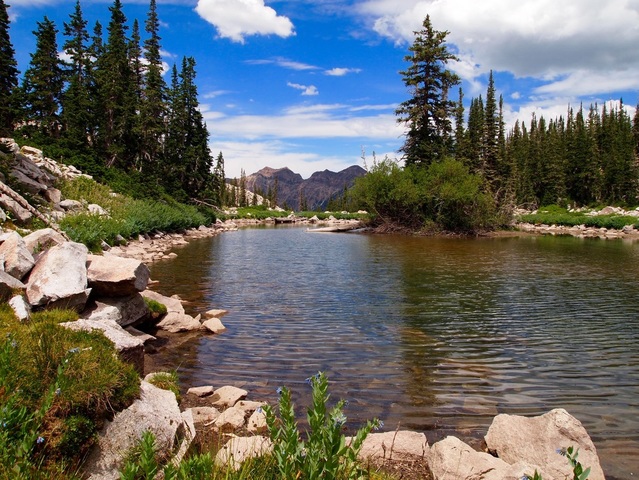
-The largest of the Maybird Lakes, looking north.
|
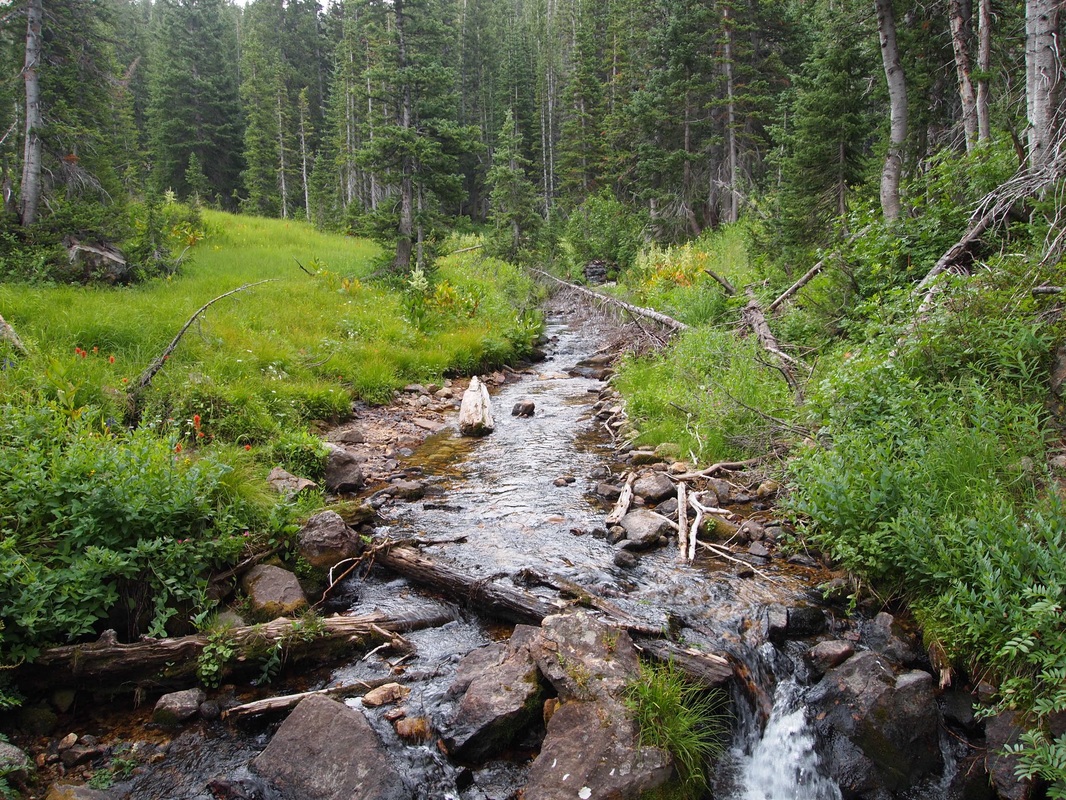
-Crossing Red Pine Creek at the Meadow Junction, looking south.
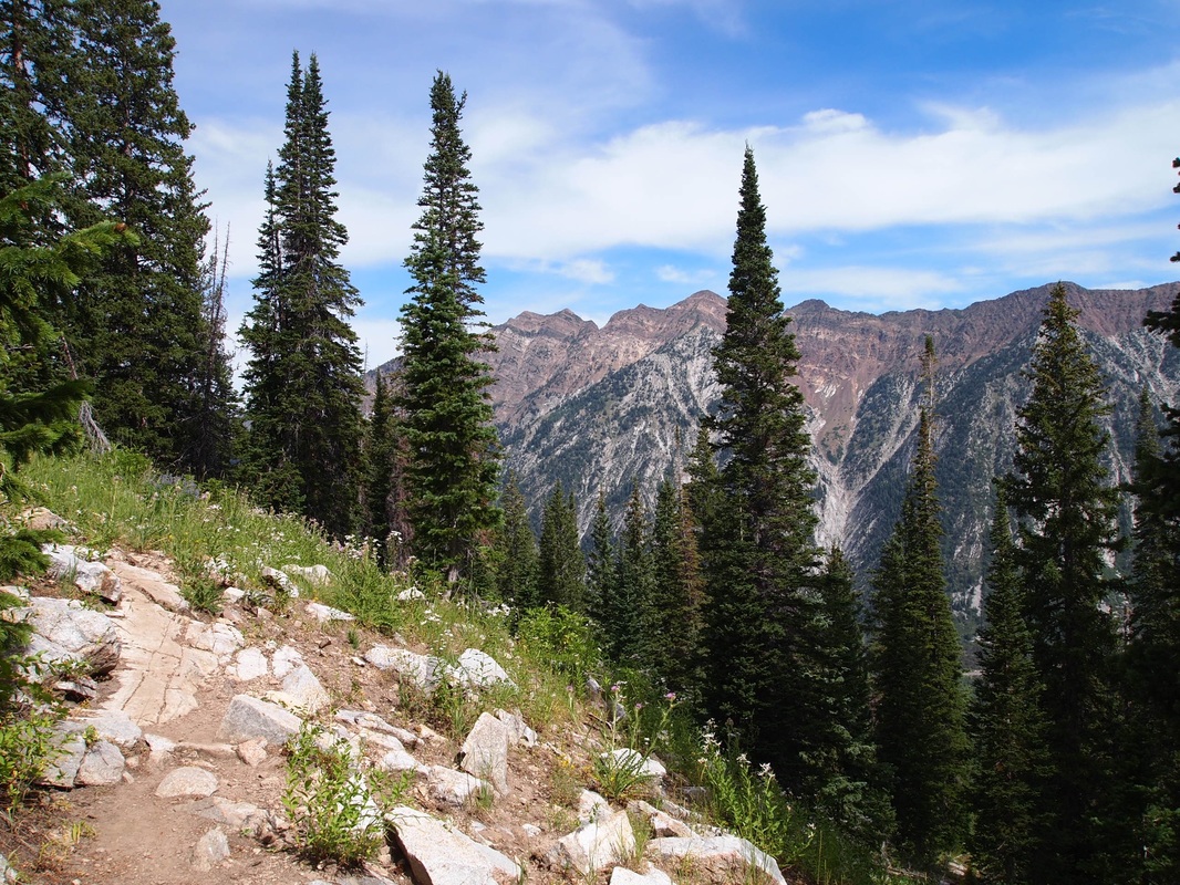
-The trail as it winds across the ridge dividing Maybird Gulch and Red Pine Canyon. Looking northwest into Little Cottonwood Canyon.
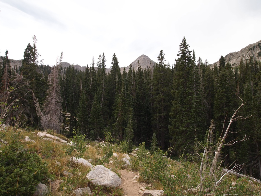
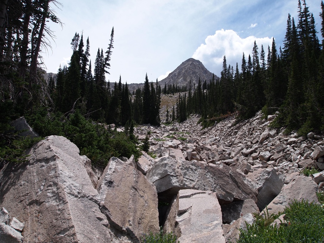
-Entering the lower section of the gulch. The Pfeifferhorn is visible in the distance above the trees.
-Looking up at the Pfiefferhorn from the lake.
|
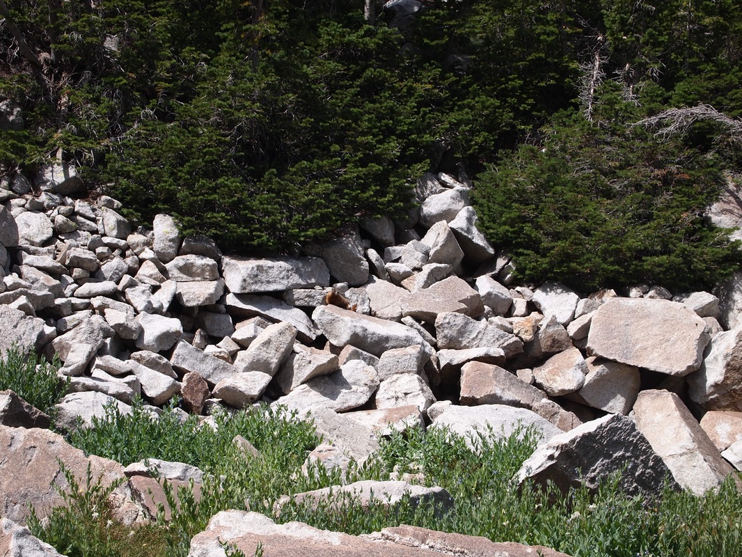
-A curious Marmot watching us eat our lunch.
