Red Pine Lake
Red Pine Lake is a large alpine lake nestled in the Lone Peak Wilderness area of Utah's Wasatch Mountains. It is located west of White Pine Canyon and north of American Fork Canyon in a high granite cirque carved by glacial activity during the last ice age. The Lone Peak Wilderness was created in 1978 under the Endangered American Wilderness act, and encompasses an area of over 30,000 acres. The wilderness is visible from both Utah and Salt Lake Valleys, located on top of what is called Mount Jordan above Draper (also known as the North mountain from the south). The most prominent peaks include Lone Peak (11,253 feet), The Pfeifferhorn (11,325 feet), and many others. The wilderness is also home to many lakes, Red Pine Lake being the most popular. There are actually three lakes in the area, Red Pine being the largest and two smaller upper lakes. Red Pine Canyon is full of diverse mountain flora and fauna, with beautiful wildflower blooms on the canyon sides in the summer. The trail to the lake is very popular and well maintained.
The trail
|
Trailhead: White Pine/Red Pine Trailhead, Little Cottonwood Canyon
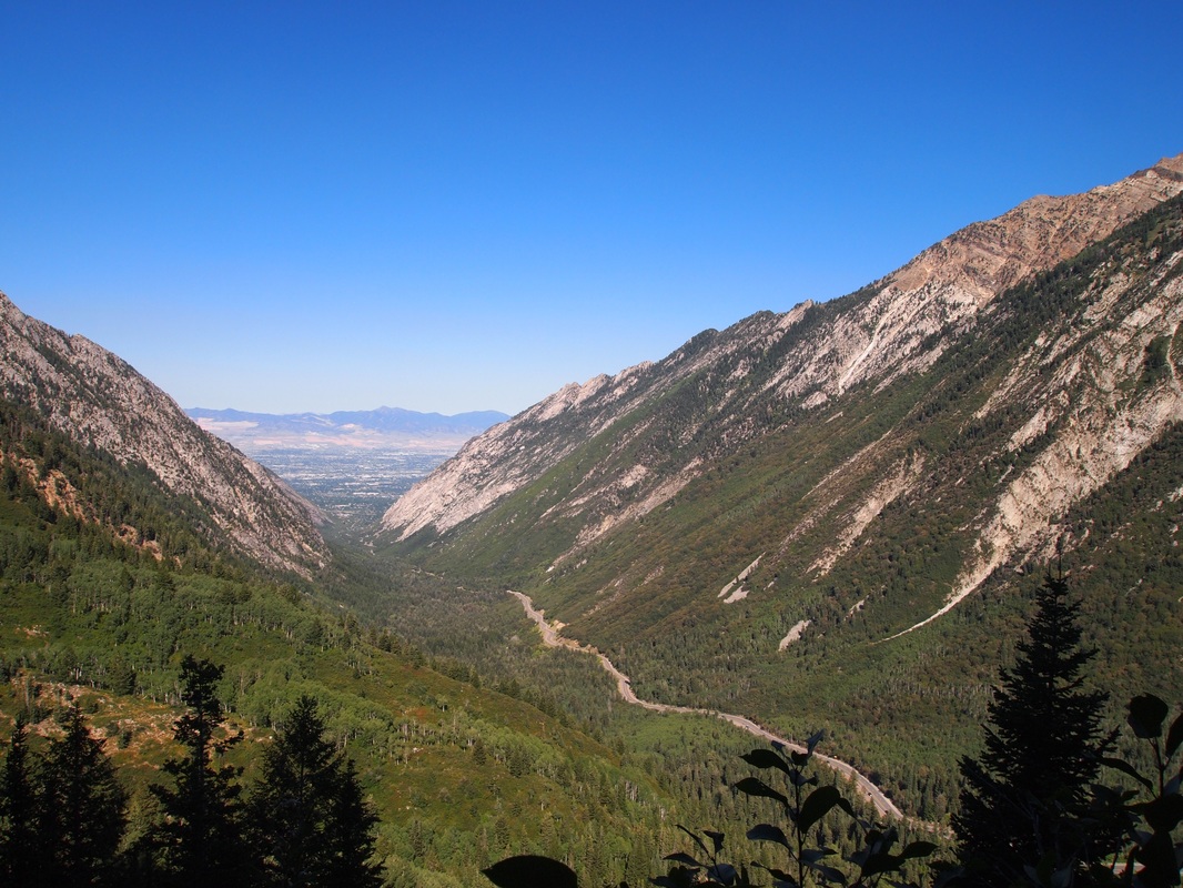
Duration: 5-8 hours Distance: 7.5 miles Difficulty: Moderate to Strenuous Directions: From I-15 take the I-215 Belt Route exit onto I-215 East. Exit I-215 at the Cottonwood Heights exit, and get onto Wasatch Boulevard heading south toward Big Cottonwood Canyon. Continue past Big Cottonwood Canyon to Little Cottonwood Canyon and turn into the canyon. Follow the Little Cottonwood Canyon road a few miles past Tanners Flat Campground until you see a sign saying White Pine/ Red Pine Trailhead. You can park on the road if the lot is full, and there is a pit toilet and trail information available. Description: The trail begins by crossing over Little Cottonwood Creek, and follows a 4x4 jeep road (likely built for logging purposes in adjacent White Pine Canyon), and climbs steadily up the side of Little Cottonwood Canyon, offering views out to the Salt Lake Valley. The jeep road comes to a fork with a back country bulletin board next to White Pine Creek. The Jeep road continues to the left to White Pine Lake, but do not go this way! The Red Pine Trail officially begins behind the bulletin board, and follows White Pine Creek for a little ways and then crosses. The trail continues around the ridge into Red Pine Canyon, and then begins to ascend up the side of the canyon. This part of the trail becomes more strenuous with large rocks and fairly steep inclines. As a result you gain elevation quickly, passing through lush aspen groves and into Spruce and Fir forests. After a couple of miles the trail comes to another fork in a small meadow near the Red Pine Creek. There is a historical unnamed mine slag pile ahead, and some make shift stairs likely made by the miners. It was likely an unsuccessful prospect, as the overburden pile is not to large, but is fairly unsightly in the adjacent meadow. This was made long before any environmental after thought was in American minds. The hole is now filled in, and was likely in the rock wall to the east. Had to be serious motivation to climb up there and dig in solid rock for metals! The prospect is a result of the 1872 Mining Law, which stated that if you could prove there was an ore body in the area that you could mine it for free (no government royalties, hoping that it would be successful to warrant investment from companies back east). The Mining Law brought flocks of prospectors into the Wasatch seeking their fortunes, with the most successful strikes occurring in Alta, Brighton, Park City, Snowbird, and American Fork Canyon. The fork to the right crosses the creek and heads toward Maybird Gulch. Continue past the slag pile and continue to climb up the canyon. After another mile or so past the mine the trail rises into the cirque holding Red Pine Lake, with White Baldy above and to the east. The trail makes a loop around the lake shore, and if you are up to the challenge, it is another half mile or so to the upper lakes. There is really no official trail, and is very steep, but is certainly worth the view if you have the time. Just follow the creek drainage on the south shore of the main lake, and you will find a make-shift trail that will take you to the upper basin at around 11,000 feet. Then just return the way you came. 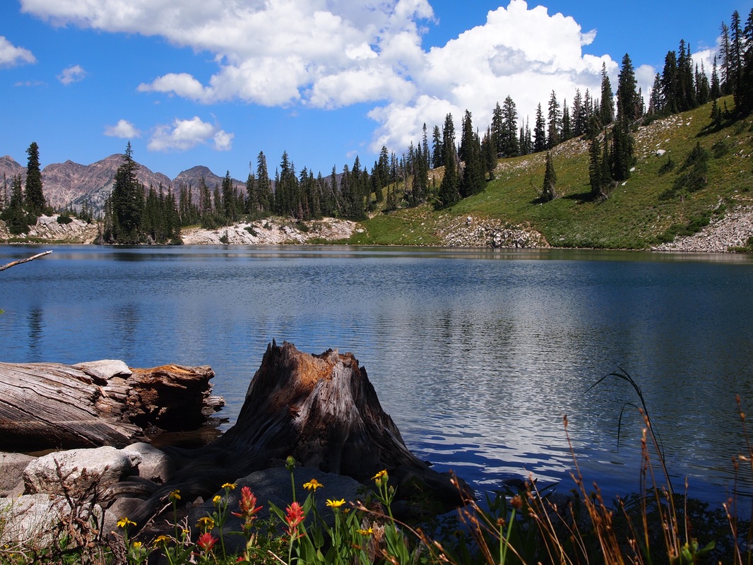
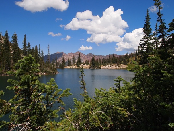
-View from lake shoreline looking northeast toward Little Cottonwood Canyon.
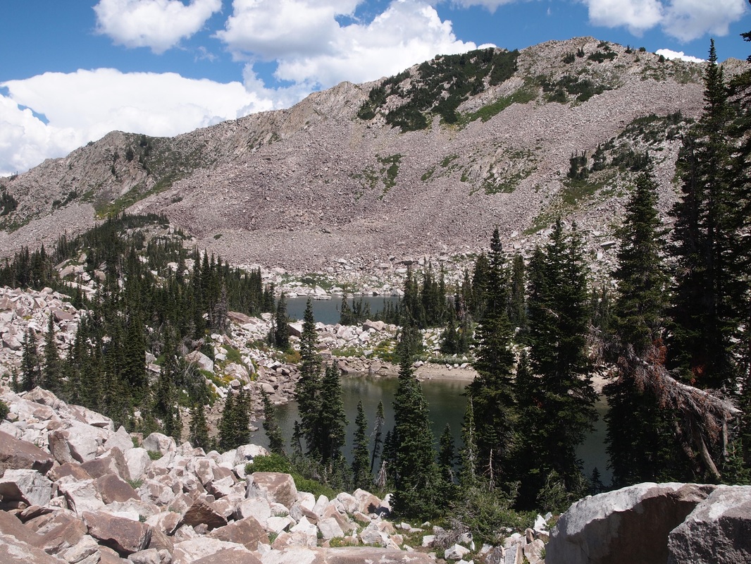
-Upper Red Pine Lakes looking east toward White Baldy North Summit.
|
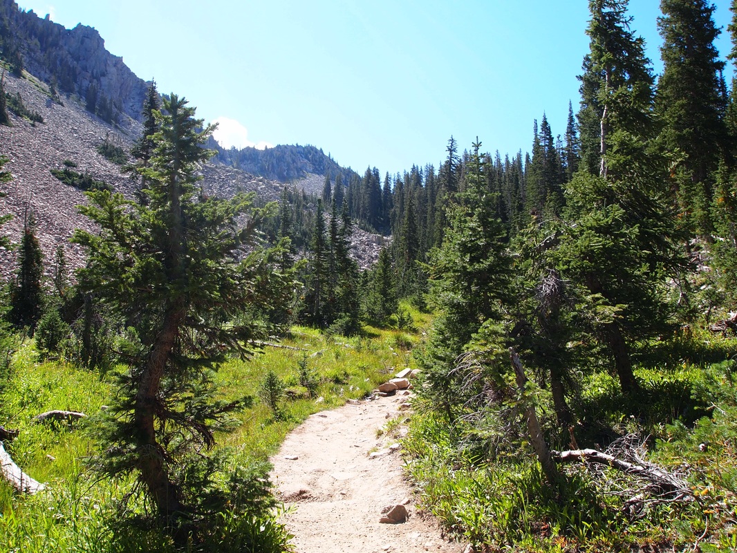
-View as the Trail climbs into Red Pine Canyon
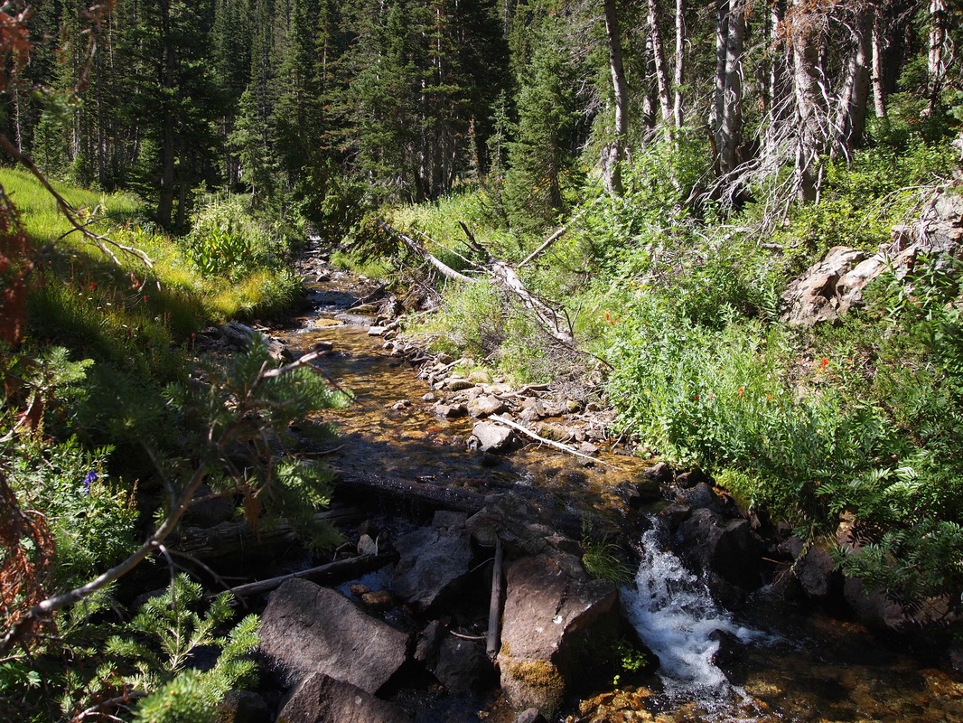
-Red Pine Creek at the auction with the Maybird Gulch Trail
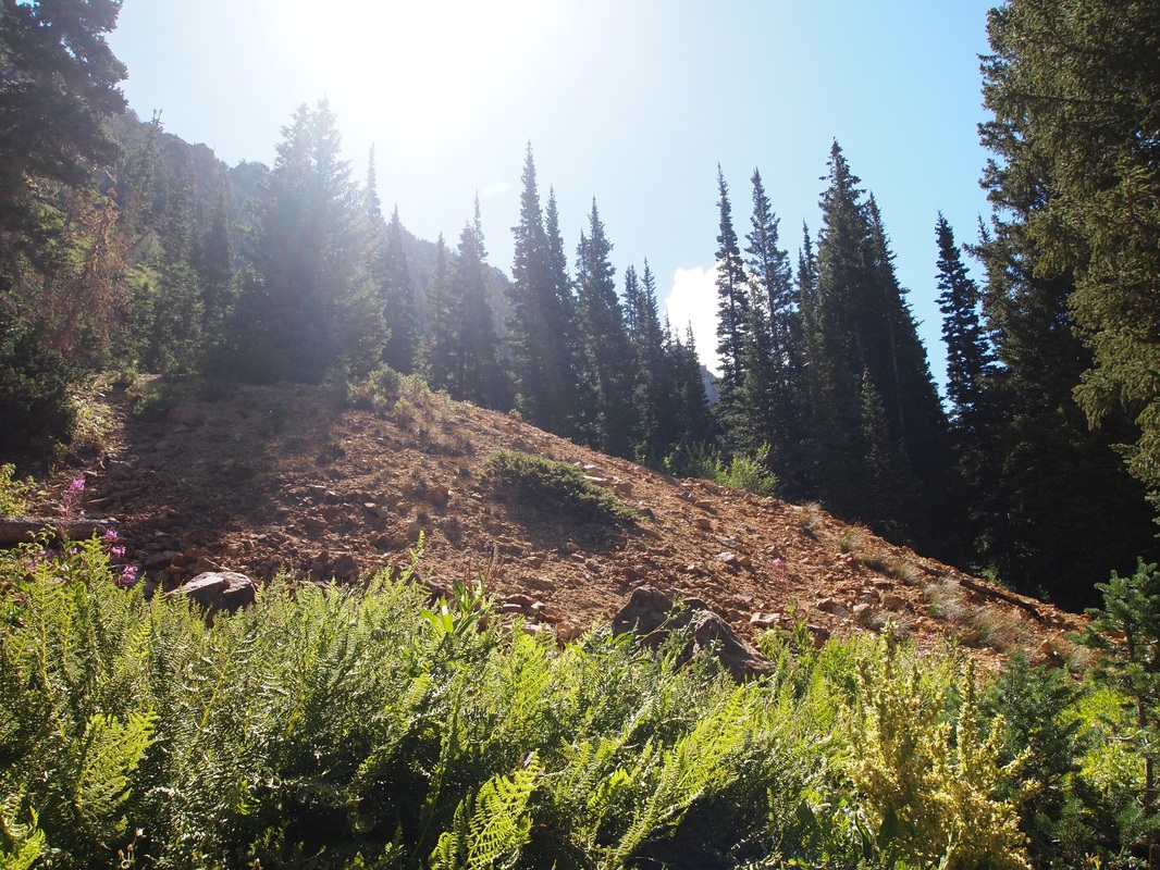
-Overburden from an undocumented mining prospect likely from around 1872-1876.
-Climbing up toward the lake above the Mine dump.
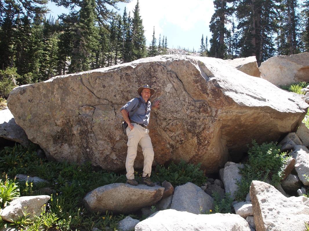
-One of many large boulders in the cirque basin.
|
